
The Simple Step That Protects Your Land from Big Legal Problems
Land is one of the most valuable and sensitive assets in Odisha. Whether you are buying a residential plot, agricultural land, commercial property, or planning construction, one small but powerful step can protect your investment — Land Survey and Demarcation.
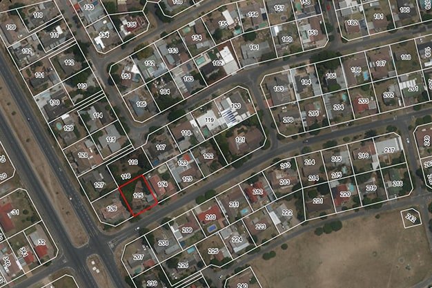
Across all 30 districts of Odisha, land disputes, encroachments, and boundary conflicts are common. Most of these issues arise because land was never properly surveyed or demarcated.
This professional guide explains why land survey and demarcation are essential in Odisha and how they protect you from costly legal and financial troubles.
What is Land Survey and Demarcation?
✔ Land Survey
A land survey is the scientific process of measuring and mapping the exact dimensions, location, and boundaries of a property using modern equipment like Total Station, GPS, and digital mapping tools.
✔ Land Demarcation
Demarcation is the physical marking of the land boundaries on the ground using boundary stones, pillars, or markers based on official government records such as:
-
Jamabandi
-
Khatian
-
Record of Rights (RoR)
-
CS & RS maps
Together, these processes ensure that your land on paper matches your land on the ground.
Why Land Survey is Extremely Important in Odisha
1️⃣ Prevents Boundary Disputes
In growing urban areas like:
-
Bhubaneswar
-
Cuttack
-
Rourkela
-
Berhampur
Rapid development often leads to unclear boundaries. A professional survey clearly defines your land limits and prevents disputes with neighbors.
2️⃣ Protects You from Legal Cases
Land cases in Odisha courts can take years to resolve. Many originate from:
-
Overlapping boundaries
-
Inherited property conflicts
-
Encroachments
-
Record mismatches
A certified land survey strengthens your legal position and provides documentary evidence if disputes arise.
3️⃣ Essential Before Buying or Selling Land
Before purchasing land anywhere in Odisha, a survey helps:
-
Confirm the exact plot size
-
Verify government records
-
Identify illegal encroachments
-
Ensure the land matches the sale deed
This is especially critical in rapidly developing districts like:
-
Puri
-
Khordha
-
Jharsuguda
-
Sambalpur
4️⃣ Required for Construction Approval
Municipal authorities and local bodies require verified land dimensions before approving building plans. In cities such as:
-
Balasore
-
Jeypore
-
Baripada
-
Bolangir
A survey ensures your building stays within legal boundaries and complies with setback norms.
Importance of Land Survey in All Districts of Odisha
Land survey and demarcation are equally important across every district:
Coastal Odisha
-
Jagatsinghpur
-
Kendrapara
-
Bhadrak
Coastal land is highly sensitive due to development, tourism, and CRZ regulations. Accurate demarcation avoids regulatory issues.
Western Odisha
-
Bargarh
-
Nuapada
-
Kalahandi
-
Subarnapur
Agricultural land boundaries must be clearly defined to access government schemes and avoid farm disputes.
Northern Odisha
-
Mayurbhanj
-
Keonjhar
-
Sundargarh
Forest proximity and tribal land regulations make proper surveying even more important here.
Southern Odisha
-
Koraput
-
Malkangiri
-
Rayagada
-
Gajapati
In hilly and tribal regions, land records can differ from physical possession — survey ensures clarity.
Common Problems That Survey Prevents
✔ Encroachment by neighbors
✔ Overlapping property claims
✔ Road widening acquisition disputes
✔ Construction violations
✔ Inheritance conflicts
✔ Sale deed mismatches
Step-by-Step Land Survey Process in Odisha
-
Collection of RoR / Jamabandi / Khatian
-
Field measurement using Total Station or GPS
-
Boundary verification with official maps
-
Physical demarcation with boundary stones
-
Preparation of certified survey report
-
Submission for record verification if required
Who Should Get a Land Survey Done?
-
Land buyers
-
Property sellers
-
Builders & developers
-
Farmers
-
Industrial land owners
-
Inherited property holders
-
Before fencing or construction
1️⃣ What is land survey and demarcation?
Land survey is the technical measurement of a property’s exact size and boundaries using modern instruments like GPS and Total Station.
Demarcation is the physical marking of those boundaries on the ground using boundary stones or pillars based on official land records.
Together, they ensure your land on paper matches your land on site.
2️⃣ Why is land survey important in Odisha?
Land disputes are common across districts in Odisha — from urban areas like Bhubaneswar and Cuttack to rural regions like Koraput and Kalahandi.
A land survey helps to:
-
Prevent boundary disputes
-
Avoid encroachments
-
Verify land records
-
Protect ownership rights
-
Secure construction approvals
3️⃣ Is land survey mandatory before construction?
Yes. Before starting construction, municipal authorities and local panchayats require accurate land measurements to approve building plans. A survey ensures your building stays within legal boundaries and follows setback rules.
4️⃣ How can I verify my land boundaries in Odisha?
You can verify your land boundaries by:
-
Checking your Record of Rights (RoR), Jamabandi, or Khatian
-
Hiring a licensed surveyor
-
Matching field measurements with official maps
-
Physically demarcating the land
5️⃣ How long does a land survey take?
The duration depends on:
-
Size of the land
-
Location (urban or rural)
-
Record availability
Typically, a standard residential plot survey can be completed within a few days, while larger agricultural or industrial lands may take longer.
6️⃣ What documents are required for land survey in Odisha?
Generally required documents include:
-
Sale deed
-
Record of Rights (RoR)
-
Plot number and Khata number
-
Previous survey documents (if available)
7️⃣ What happens if I don’t do land demarcation?
Without demarcation, you may face:
-
Boundary disputes
-
Encroachments
-
Legal conflicts
-
Construction violations
-
Problems during resale
In growing districts like Puri, Sambalpur, and Jharsuguda, proper demarcation is especially important due to rapid development.
8️⃣ Can land survey help in resolving disputes?
Yes. A certified survey report provides legal evidence in case of disputes. Courts and revenue authorities rely on official survey measurements to settle boundary conflicts.
9️⃣ Is land survey required for agricultural land?
Absolutely. In districts like Bargarh, Balangir, and Mayurbhanj, proper land measurement helps farmers:
-
Access government schemes
-
Prevent farm boundary disputes
-
Secure crop insurance
-
Avoid encroachment issues
? How often should land be surveyed?
Land should be surveyed:
-
Before buying or selling
-
Before construction
-
After inheritance division
-
If boundary disputes arise
-
If government acquisition is expected
Final Advice
Whether your land is in metropolitan areas like Bhubaneswar or remote districts like Malkangiri, one fact remains the same:
Land Survey and Demarcation is not optional — it is essential.
It protects your ownership, prevents disputes, ensures legal safety, and safeguards your investment for generations.
Before buying, selling, constructing, or fencing land anywhere in Odisha —
Get your land surveyed and demarcated professionally.

MistriBabu
Admin